Property Details
Yocum Cove Parcel 2
- County Development and Occupancy Permits Required
- Off-Grid; Grid Electricity Available
- Adjoins Bull Shoals Take-Line
- No Mobile Homes
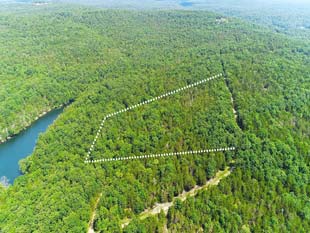
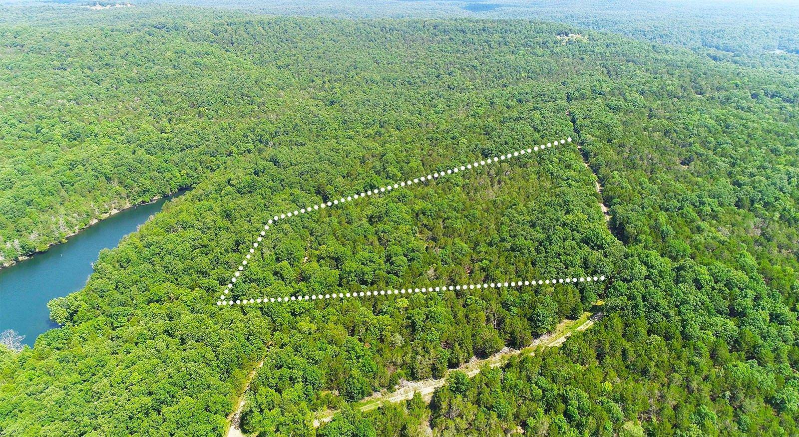
This parcel is covered with a lush forest of eastern red cedar interlaced with oak and hickory. Like most of northern Arkansas, the topsoil is thin here and rock is in abundance.
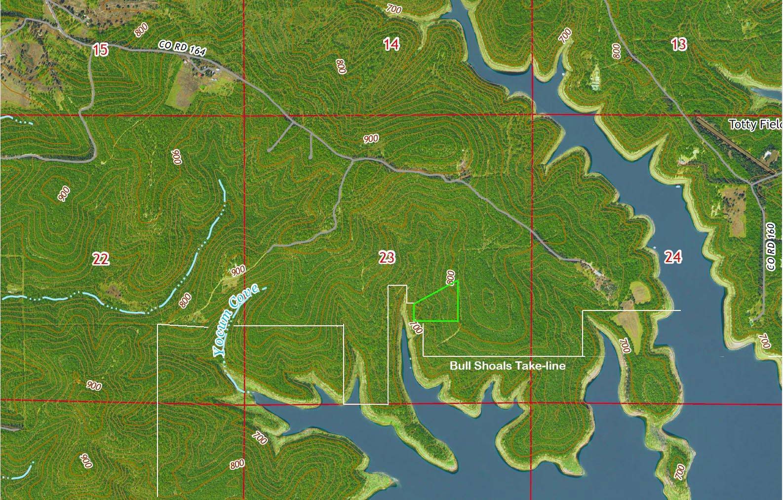
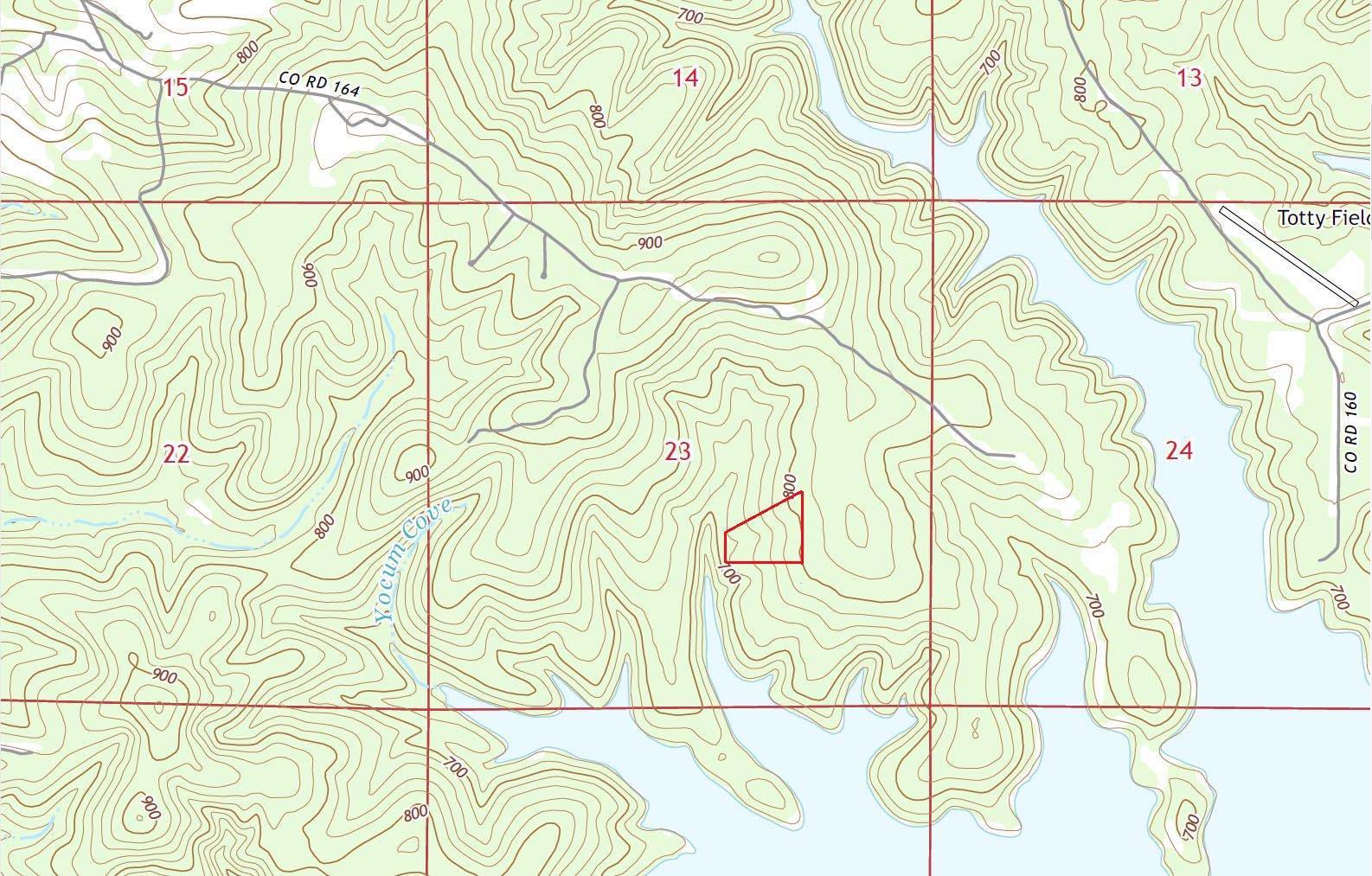
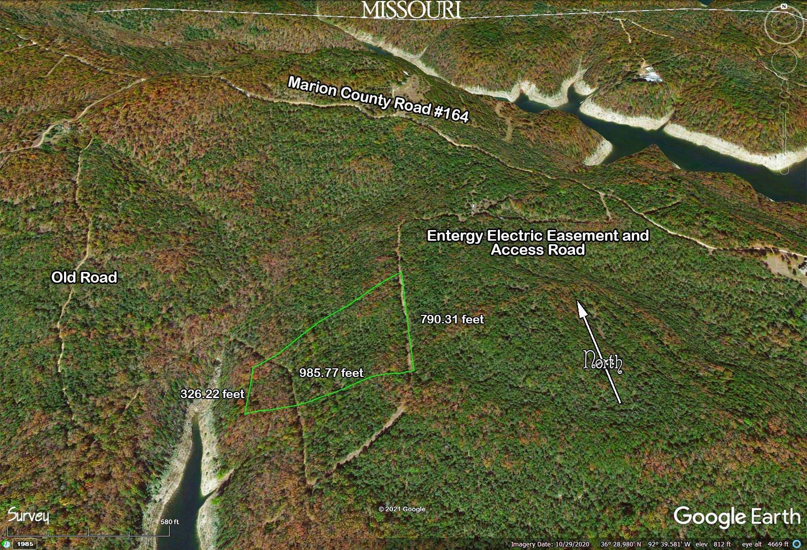
As you’ll see from the topography maps we’ve posted, this parcel is level enough to provide building space on almost any part of the property, particularly on the east side. You’ll also notice that the northwest corner of the land is about 150 feet of elevation higher than the surface of the lake. There’s 490 feet of frontage along the lake take-line (the government boundary).
There is road access to either side of the property. On the east is a cleared right-of-way for ingress, egress, and electrical transmission although power lines have not yet been installed. This is currently the best route in, as it is much leveler and car-friendly than the old road that you’ll find on the west, which requires four-wheel-drive, but also may be handy to access the west side of the property.
Size
10.55 acres, surveyed in 2009.
Legal Description
TRACT 2 A PART OF THE NW1/4 OF THE SE1/4 SECTION 23, T21N R16W MARION COUNTY, ARKANSAS DESCRIBED AS FOLLOWS; BEGINNING AT THE SE CORNER OF THE NW1/4 SE1/4, A ALUM. CAP, THENCE S 89ø11'17"W 821.23 feet, THENCE N 1ø29'22"W 326.22 feet, TO A CORPS OF ENGINEER MONUMENT, THENCE N 59ø33'55"E 938.85 feet, TO A 3/8" REBARTHENCE S 1ø27'38"E 790.31 feet, TO THE POINT OF BEGINNING. CONTAINING 10.55 AC.
Title
We will pass Fee Simple Title to the purchaser conveying 100% of the ownership of the property including all timber, mineral and water rights. We own this property free and clear of all tax liens, judgments mortgages or other encumbrances. As purchaser, you are not assuming any existing liens. We will record a Warranty Deed to the property in your name after you have made six monthly payments.
Access
The Property is accessed from Marion Country Road 164, an all-weather gravel road maintained by Marion County, Arkansas by a 1/2-mile jeep trail on the west and a 4/10-mile driveway and power easement on the east.
Utilities:
Water
We do not supply water or water systems to any of these properties. Purchasers of these parcels need to arrange to drill their own private water well. For information on drilling procedures, you should contact local well-drillers. Current prices charged by local well-drillers run around $8 per foot to drill and $9-13 per foot to install a 6-inch casing. Arkansas law requires a minimum of 80 feet of casing in all locations and more in some. The estimated cost of a complete well, casing and pump system in this area is $7,500. Permits are not required to drill water wells for single-family dwellings; however, you are required to hire a state-licensed well driller.
Electric
This parcel is off-grid. That is, electrical service has not been extended to the property. Commercial electricity is provided to the area by: Entergy-Arkansas www.entergy-arkansas.com, 800-368-3749.
Telephone and Internet
Telephone and internet services are provided to Jones Point by CenturyLink, 800-201-4099. http://www.centurylink.com/ For cell phone service, we recommend US Cellular and for internet, a satellite provider.
Septic
You may not take up occupancy until you provide sewage disposal for your property in the form of either:
(A.) a septic tank and leach field, or (B.) a commercially manufactured composting toilet system.
The State of Missouri says that any septic tank and leach field on less than three acres must be installed to Missouri Department of Natural Resources specifications. You can get information on these by speaking to the Health Department in your respective County Seat.
Since they do not endanger the ground-water, properly operated and maintained composting toilets are not restricted, and thus are permitted at all locations.
Garbage Disposal
Open dumping is illegal in the state of Arkansas. Before occupying the property, you must make arrangements with a State-approved garbage collection company
Gas
Propane gas is available from local dealers.
Mail Delivery
Mail is delivered to Yocum Cove on Marion County Road #164. To establish a mailbox there, contact the postmaster at the Theodosia Post Office.
Deed Restrictions
There are no deed restrictions on this property.
Deed restrictions are restrictions on this property which have been recorded with the county, and which will remain in effect even when the property changes hands. Our contract, which expires when you no longer owe us money, contains certain requirements in addition to these.
Click HERE to see a Sample Contract
Taxes
$100 (estimate)
Building codes and/or permits
Marion County requires that prospective occupants obtain both a Development Permit ($100) and an Occupancy Permit ($100). Contact the Marion County assessor for more information, 870-449-4113.
Driving Directions to Locate The Yocum Cove Parcel 2
Be sure to take paper copies of our maps of the property with you.
From Theodosia, go west on Highway 160 to Highway P, which you take to the left or south. Follow Hwy. P until you get to the Dugginsville Church, or just feed “Dugginsville, MO” into your GPS. This is where the pavement ends. Follow this road south until you see an intersection with a sign that reads “Marion County, Ark”. This is Marion County Road Number 163. Continue about 1 1/2 miles on Road 163, then bear LEFT onto Road 164. Continue on Road 164 for exactly 1 mile to the intersection with an un-marked county road on your right. This is the “Old Road” mentioned on our maps. Continue on for another 7/10 mile to a driveway on your right marked by an American flag. The property begins 4/10 mile beyond on the right.
Disclaimer: These directions are accurate to the best of our knowledge but cannot be guaranteed. Visit this property at your own risk, we are not responsible for accidents.
No Down Payment - Warranty Deed after Six Months
Welcome to OzarkLand.com where, since 1982, we have dedicated ourselves to making Ozark Mountain land available to anyone who sincerely wants to own it, on a first-come, first-served basis. You don’t need to make a sizeable down payment, or any down payment at all—just start making the monthly payments.All of the properties we sell are owned by us, free and clear. That means that when we pass title to you, you don't need to worry that some disinterested third party—such as a bank—may own an interest in the property. This is frequently not the case in the real estate world at large.
We give you a Warranty Deed guaranteeing the title—no lease-options, no long-term land contracts, but fee-simple title to the property after only six months' timely payments.
All of the properties featured in our inventory are available to you via our very liberal financing plan. In fact, we’ll finance your whole land purchase with less paperwork and frustration than you'd experience buying a used car, and with no hidden expenses and one low-interest rate that’s remained unchanged since 1982.
We'll set up a contract with you in return for one monthly payment. After six monthly payments, we give you a Warranty Deed to the property, and we hold a Deed of Trust and Quit-Claim Deed as security. We record the deeds at the county courthouse at our expense, and we pay all closing costs.
There are no penalties for pre-payment.
Terms are 9% simple interest for 15 years.
Check out the "How It Works" page for more information.
- House
- 911.83 Bedrooms
- 8990 Bathrooms
- 10.55 acres
